 |
| Downtown Providence near the start line. The building is part of the old train station. |
 |
| Mile 2.5 in the marathon (mile 10 on my run yesterday). Whole Foods was a great place to use the facilities and refill my bottle. Spectators on race day can grab a morning bite here before the marathoners head to East Providence and the 1/2 marathoners head up the East Side. |
 |
| Looking across the cove at the Metacomet Country Club at mile 5.5. |
 |
| Beautiful Bullocks Cove at mile 10.5. At low tied you can see the hulls of 3 boats from years gone by. |
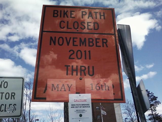 |
| At mile 20.25 I was met with this sign! I had stopped to chat with some workers on the East Bay Bike Path about a mile before the sign. I asked them if the EBBP would be open again in time for the Coxs Marathon. They indicated that the construction was now scheduled to be finished in mid-May and the marathon was being rerouted on the Veterans Memorial Parkway both coming and going. The sign seemed to confirm what they said. |
 |
| At mile 24 we head across the Washington Bridge back into Providence. The Brown University boathouse is down there on the water. |
 |
| Coming off the west end of the Washington Bridge there are stairs and a bike ramp leading down to street level. |
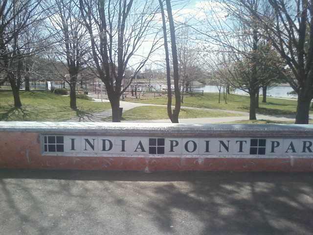 |
| India Point Park is near the base of the bridge on the route out and back for both the full and the half...and yes that is a playground in the picture. Looks like their is a water and Gatorade stop near it. |
 |
| At mile 25.25 we head under the I-Way bridge for I-195. They managed to make the new bridge very decorative. |
 |
| Downtown Providence here we come! |
 |
| The Courthouse is set into the Benefit Street hillside. Get ready to turn left and finish this thing! |
 |
| We crossed the finish line and there is the skating rink all filled with beverages and snacks. Now we just need to get down another flight of stairs to get to it! There are some viewing bleachers on the left there to kick back and recover on. |
Erin, so great to see all these pictures from the marathon course! I know the half course from last year, but the marathon will be nearly all new terrain. I just want to see that stupid hill in mile 7 and again at 20, so I know what we're in for...
ReplyDeleteDid you check out the other photo reports from the course? http://lovedisneyrunning.blogspot.com/2012/03/coxs-marathon-mid-race-sights.html
DeleteJust tell yourself they are really just inclines and before you know it you will have gone from the bottom to the top! Have faith and just keep turning it over! Have a great race!
ReplyDelete